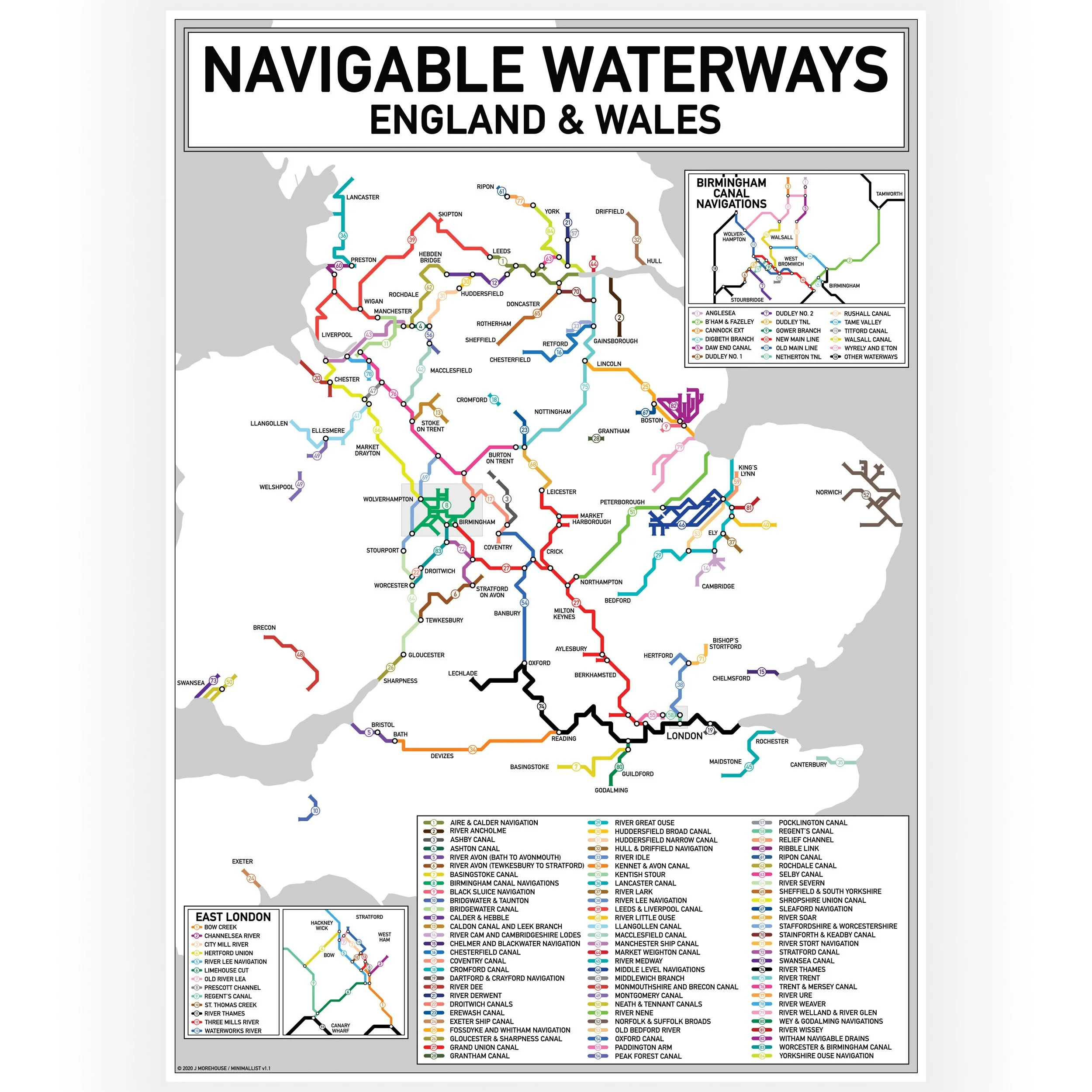
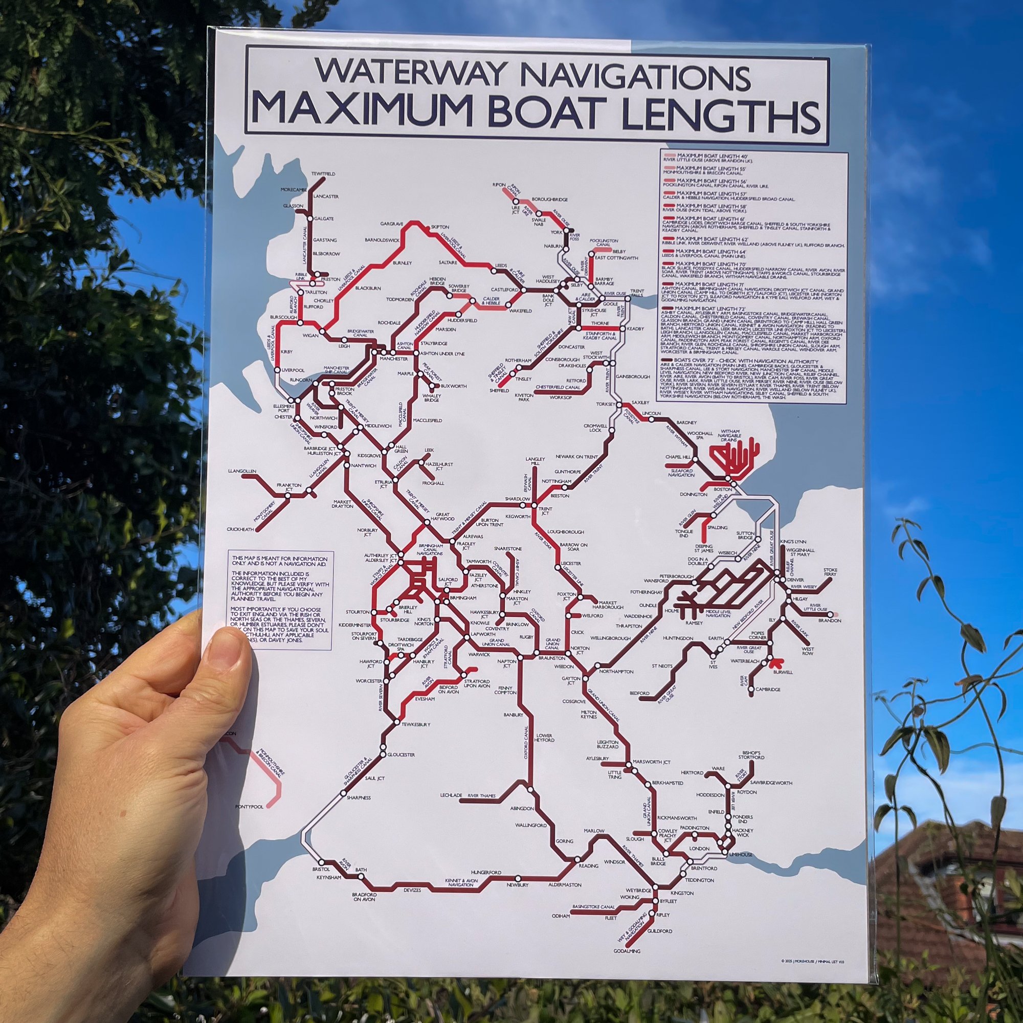
Canal and navigable rivers map surveyed by William Swires for Baines, Lancashire, published in 1888.
Print size - A3 - 297 x 420 mm 300gsm Archival Uncoated
Print size - A2 - 420 x 594 mm 200gsm Uncoated
UK orders are despatched from our narrowboat home.
Orders outside the UK are printed on demand and shipped by a local print partner.
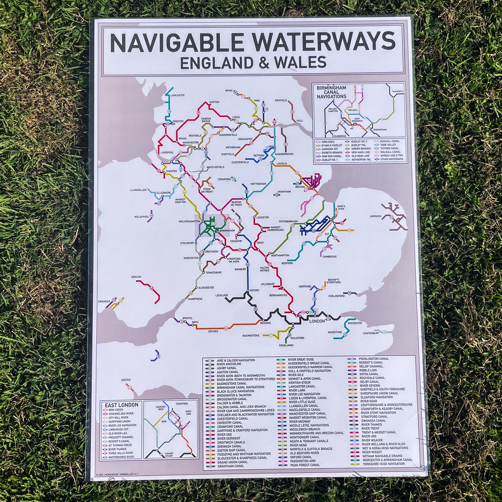
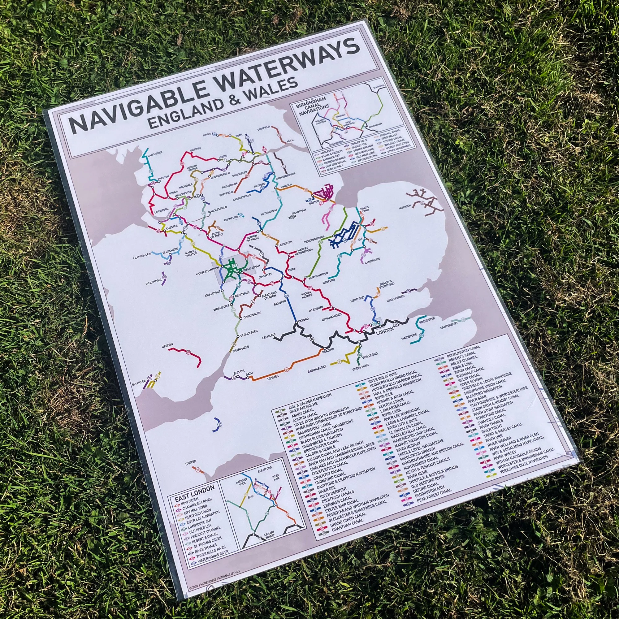